Data Science Portfolio
Personal Projects and Curiosity-Driven Explorations
Basic GIS in snippet
arcgispro
map
esri
snippet
Exploring geospatial relationships
arcgispro
geospatial
map
esri
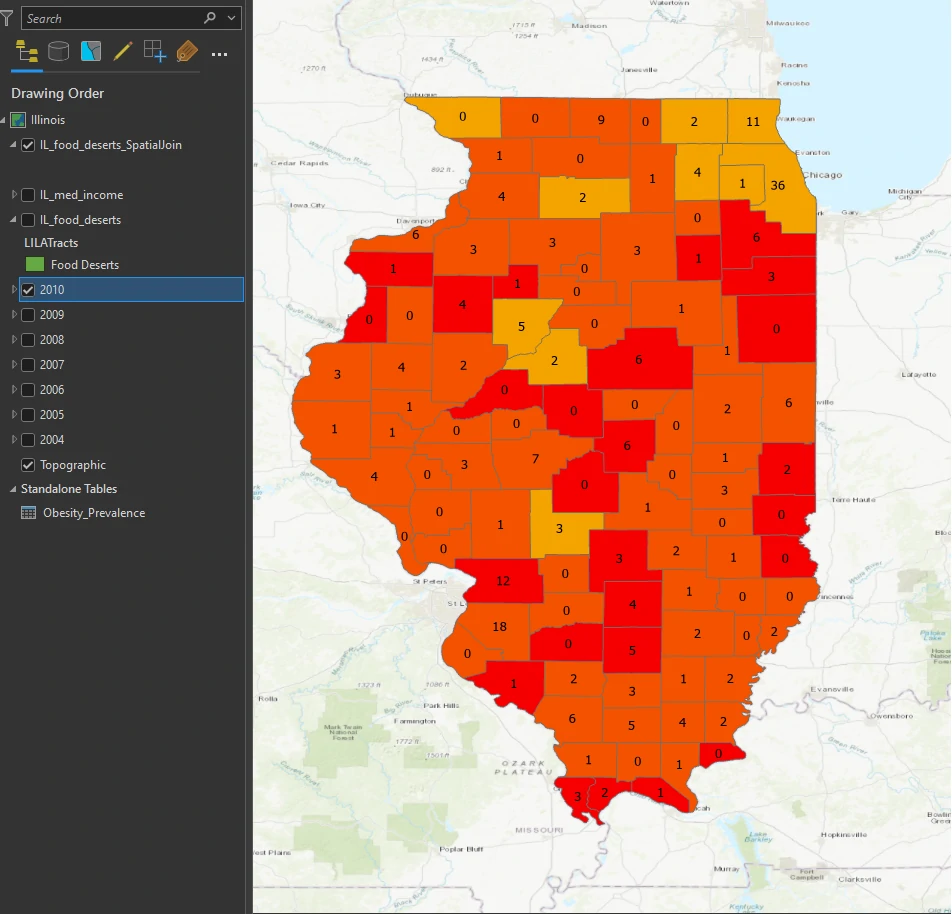
We will explore obesity prevalence rates by county, create visual aids for displaying a year-over-year rising trend, and begin to explore possible reasons why some counties may have higher prevalence rates than others. For instance, is there a link between average income level and obesity levels? What about comparing obesity rates to data that shows limited access to grocery stores—are these “food deserts,” with lesser accessibility to healthy foods, more likely to have higher obesity rates?
Modifying Spatial Data
arcgispro
geospatial
map
esri
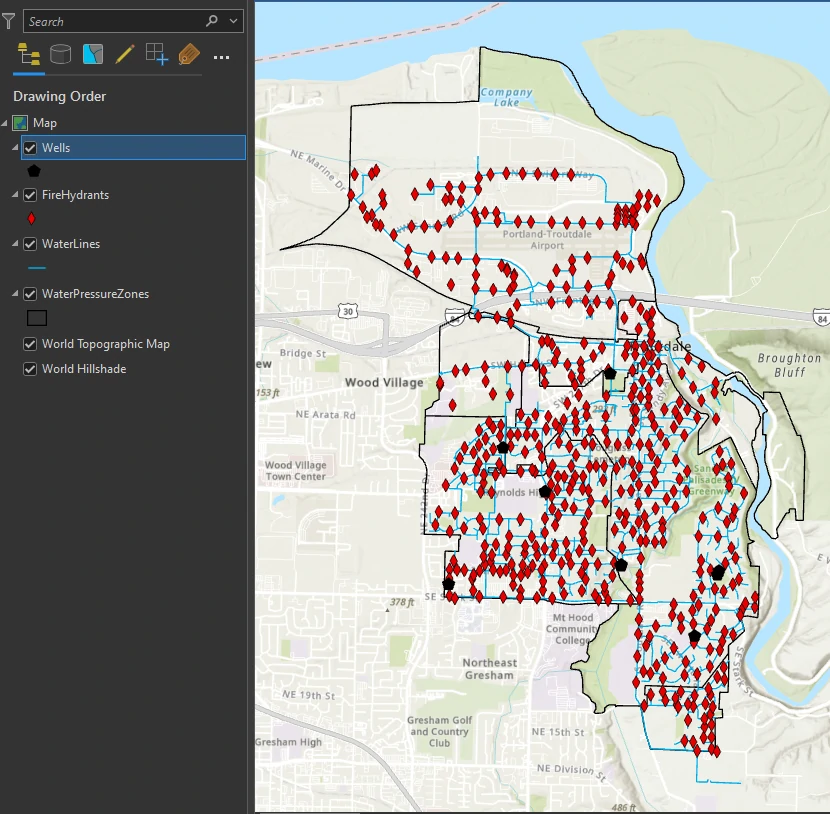
We work in the GIS department of Troutdale, Oregon. One of our jobs is to maintain the city’s GIS database. We are considering converting all the city’s shapefiles into the geodatabase feature class format because we want to take advantage of the benefits offered by the geodatabase.
Basic Presenting Map Project
arcgispro
geospatial
map
esri
Maps convey our ideas about locations to the minds of map readers. It is a fine balance of communicating the appropriate amount of information by displaying data and graphic elements through a suitable medium, such as a paper map or mobile device.
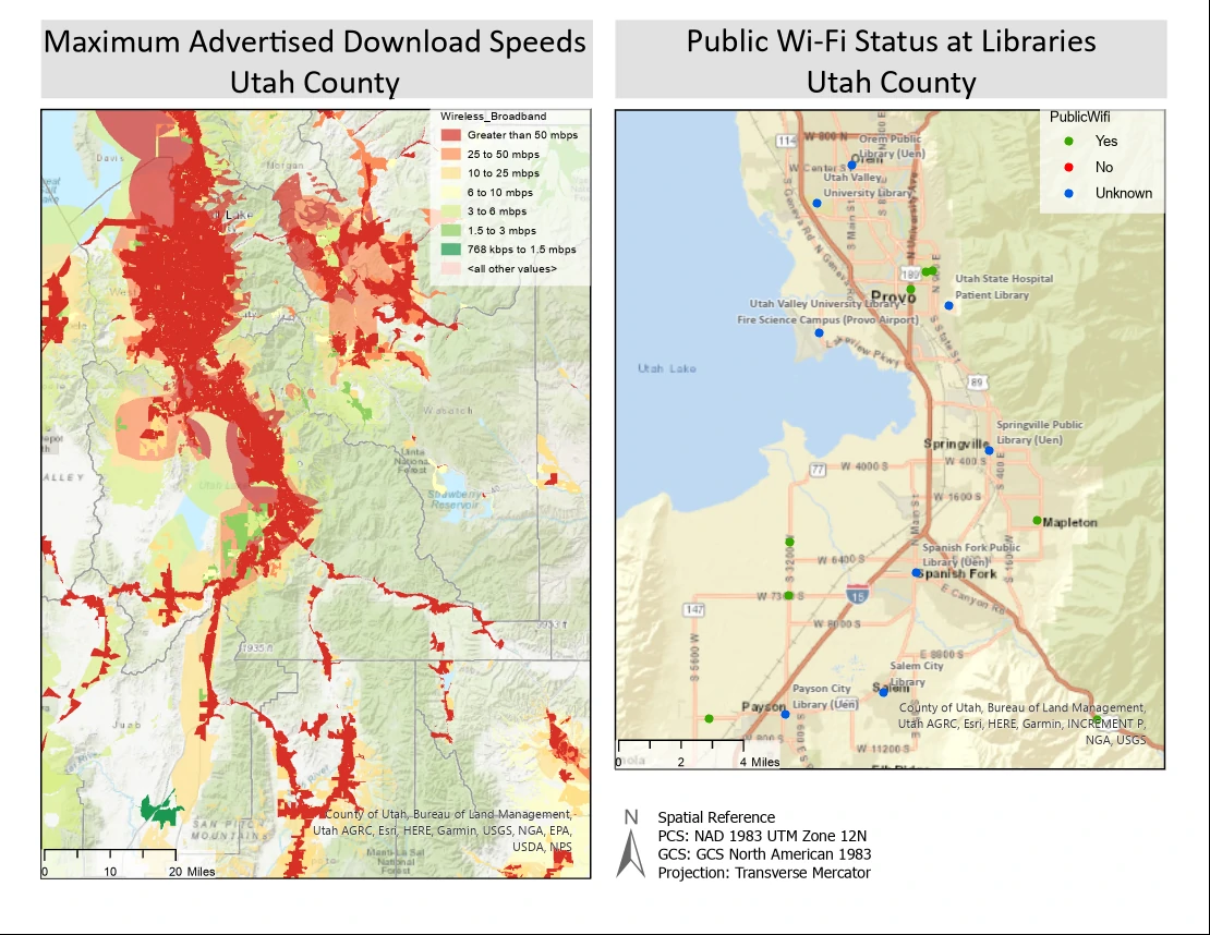
In this project we are The agency that work for aggregates much of the broadband accessibility data for the state of Utah. As part of the agency’s ongoing activities, it will determine broadband internet availability and work with stakeholders and service providers to identify accessibility, support broadband planning and policy, and study broadband trends.
Geoprocessing Model - Automating tasks
arcgispro
geospatial
map
esri
In this project we will learn three ways for storing and automating multiple-operation workflows. Workflow definition, storage, and automation facilitate and standardize geospatial solutions. These capabilities are especially useful for organizations that anticipate performing a workflow many times.
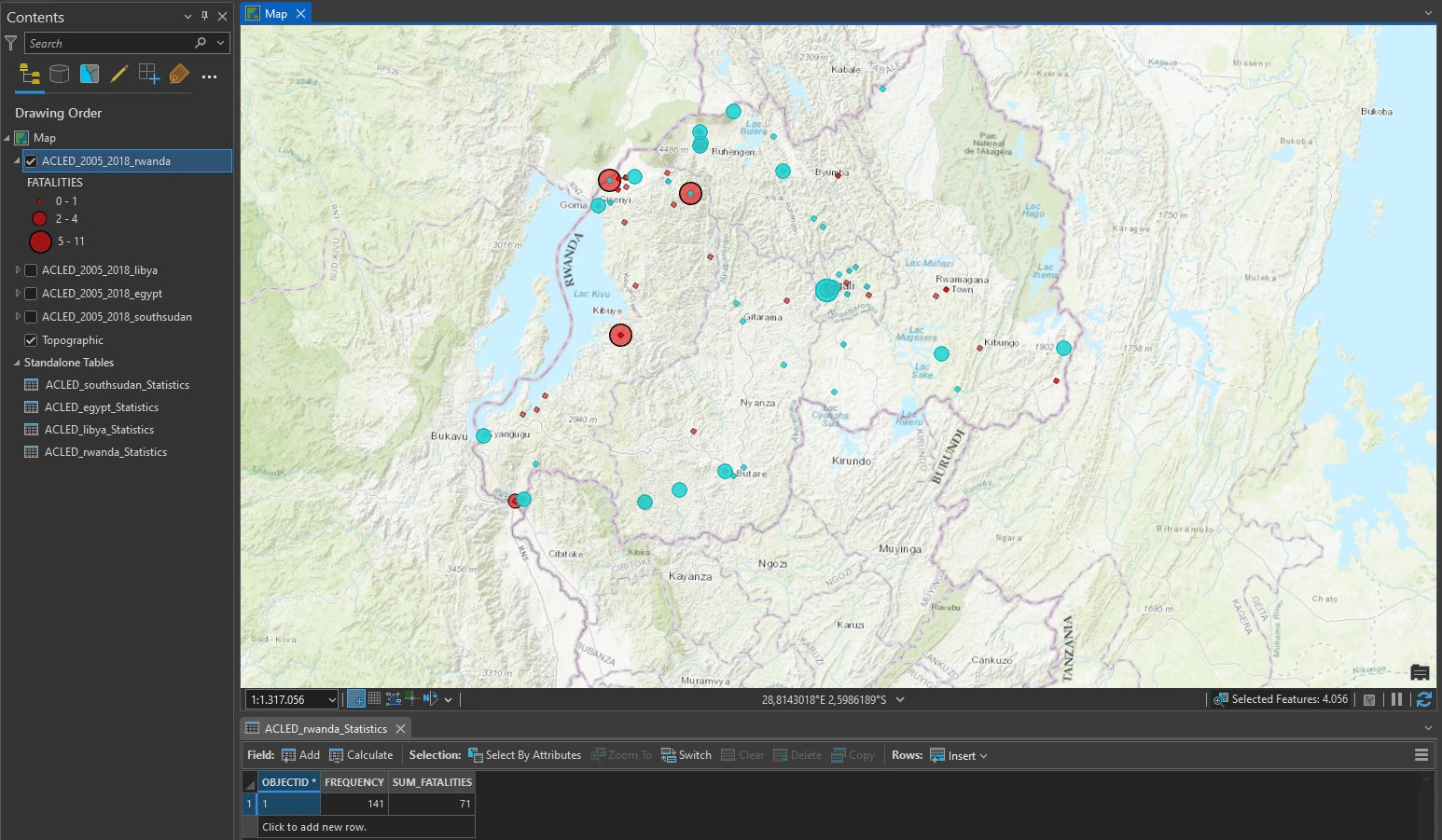
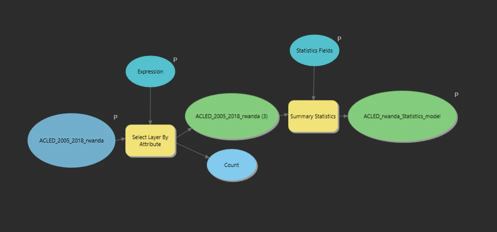
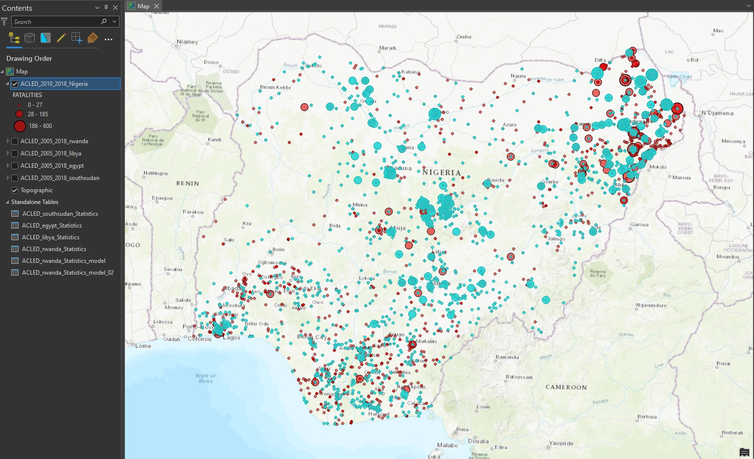
We are employed by a nonprofit agency whose primary objective is to raise awareness of and develop solutions for international human rights violations. Taking advantage of the public information offered by the Armed Conflict Location and Event Data (ACLED) project, we are creating maps that convey the impact of political violence in developing countries. We will present our maps at an international human rights conference for eventual incorporation into an awareness campaign.
Geoprocessing Model - ModelBuilder
arcgispro
geospatial
map
esri
In this project we will learn three ways for storing and automating multiple-operation workflows. Workflow definition, storage, and automation facilitate and standardize geospatial solutions. These capabilities are especially useful for organizations that anticipate performing a workflow many times.
We are employed by a nonprofit agency whose primary objective is to raise awareness of and develop solutions for international human rights violations. Taking advantage of the public information offered by the Armed Conflict Location and Event Data (ACLED) project, we are creating maps that convey the impact of political violence in developing countries. We will present our maps at an international human rights conference for eventual incorporation into an awareness campaign.
Geoprocessing Model - Automating with Python
arcgispro
geospatial
map
esri
In this project we will learn three ways for storing and automating multiple-operation workflows. Workflow definition, storage, and automation facilitate and standardize geospatial solutions. These capabilities are especially useful for organizations that anticipate performing a workflow many times.
We are employed by a nonprofit agency whose primary objective is to raise awareness of and develop solutions for international human rights violations. Taking advantage of the public information offered by the Armed Conflict Location and Event Data (ACLED) project, we are creating maps that convey the impact of political violence in developing countries. We will present our maps at an international human rights conference for eventual incorporation into an awareness campaign.
Geo-enabling data - geocoding
arcgispro
geospatial
map
esri
In ArcGIS Pro, we can also create features from information that describes or names a location—typically an address—through a process called geocoding. In some cases, we are often faced with situations in which data is not readily available. One of the advantages of geocoding is the ability to quickly create data from a list of points of interest that we have collected or researched.

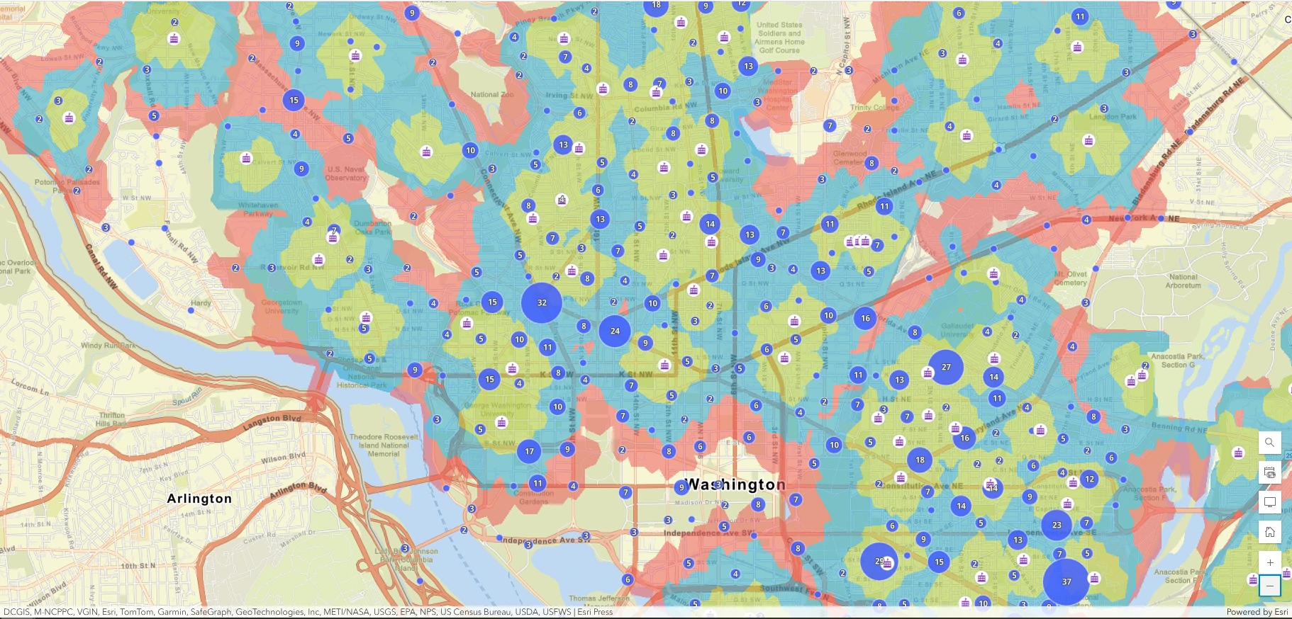
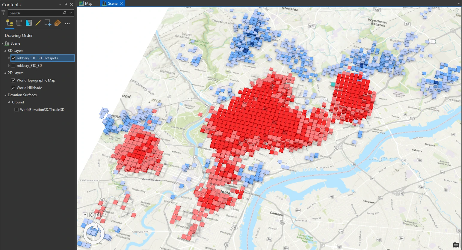
Analyzing spatial and temporal patterns
arcgispro
geospatial
map
esri
Crime mapping analysts can use GIS to identify spatial patterns to gain a better understanding of the role of location, proximity, and opportunity while providing key decision-makers with information to put crime prevention solutions in place.
Time is an important variable in analyzing crime. When using temporal data — in this case, crime incidents collected at a specific location and specific time — it is possible to see how patterns of crime shift over time and geography. If data is collected or surveyed to represent an instance in time—over the course of one day, one month, one year—the inclusion of time in a dataset’s attributes gives temporal data the necessary information for a GIS to perform spatial and temporal analysis.
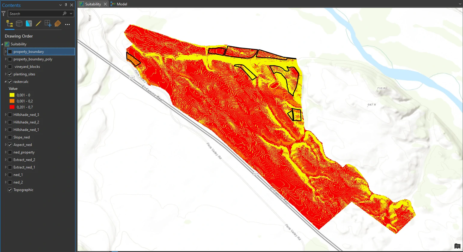
Determining suitability
arcgispro
geospatial
map
esri
In this project, we will solve a common GIS problem: determining which areas are most suitable for a specific land-use purpose.