Data Science Portfolio in Geospatial topic
Personal Projects and Curiosity-Driven Explorations
Data & Insight Showcase - Spatial Data Science
geospatial
map
data science
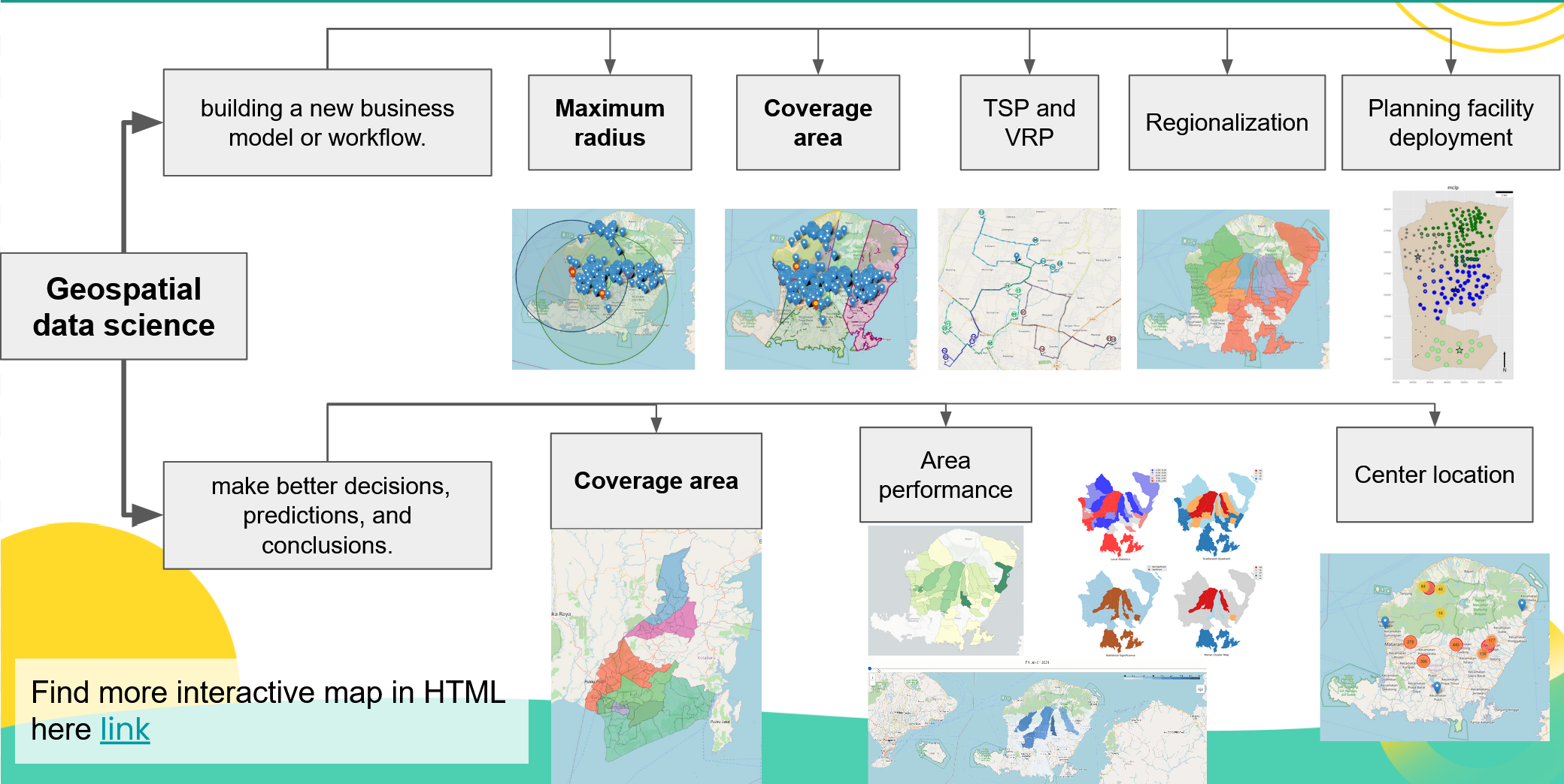
What is spatial data science?
spatial data science is a process to solving problems what relate to spatial algorithms and geographical data (location, address, longlat, etc).
Optimizing Cross-Docking Location Through Heat Map Analysis
geospatial
map
cross-docking

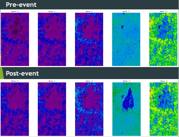
Change detection in multitemporal remote sensing images
geospatial
map
change detection
multitemporal
remote sensing
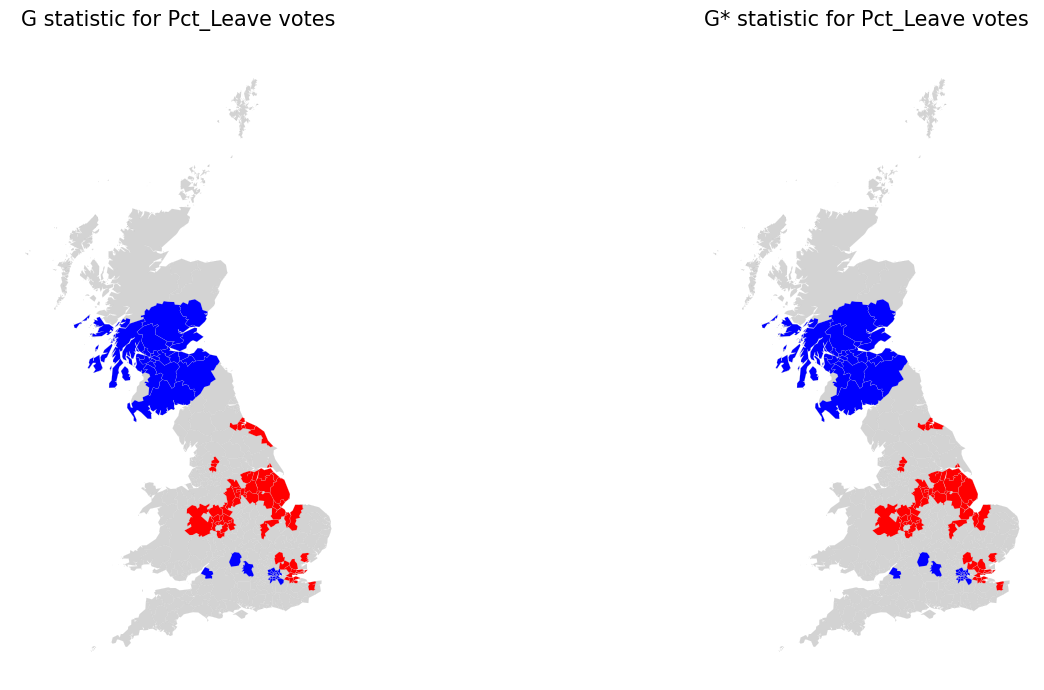
Spatial hypotesis and autocorrelation Analysis
geospatial
map
hypotesis
This project focuses on the one of critical part of exploratory spatial data analysis (ESDA), which is testing for spatial structure present within data.
Testing for spatial structure is important because if it is present in data, then we’ll want to leverage that spatial structure to enhance our downstream analysis. This can be done by using specialized algorithms during a model-building process that can understand patterns from both data and geographic space.
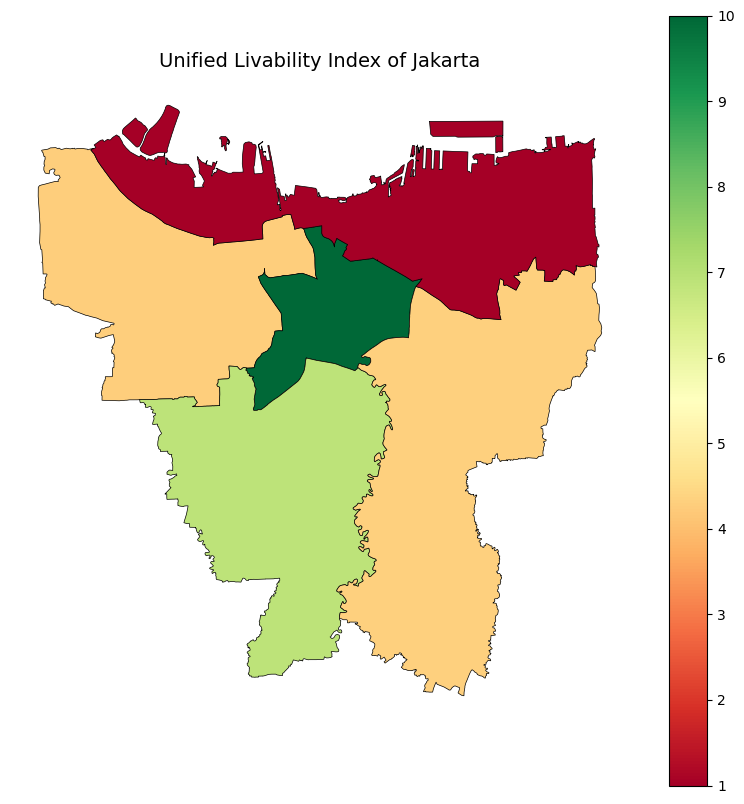
Simple Livability Index: Measuring Quality of Life Across City Districts
geospatial
map
Livability Index
Finding the perfect place to live isn’t just about personal preferences—it’s also about the environment, opportunities, and overall quality of life a neighborhood can offer. The Simple Livability Index aims to provide a clear, data-driven way to compare different city districts, scoring each one from 1 to 10 based on key livability factors.
Links
- Source code on my github