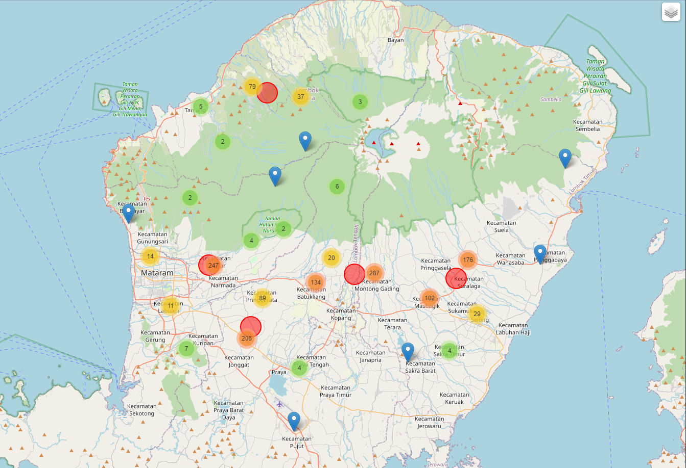
Clustering area - get center location
geospatial
map
Clustering
Clustering area - get center location
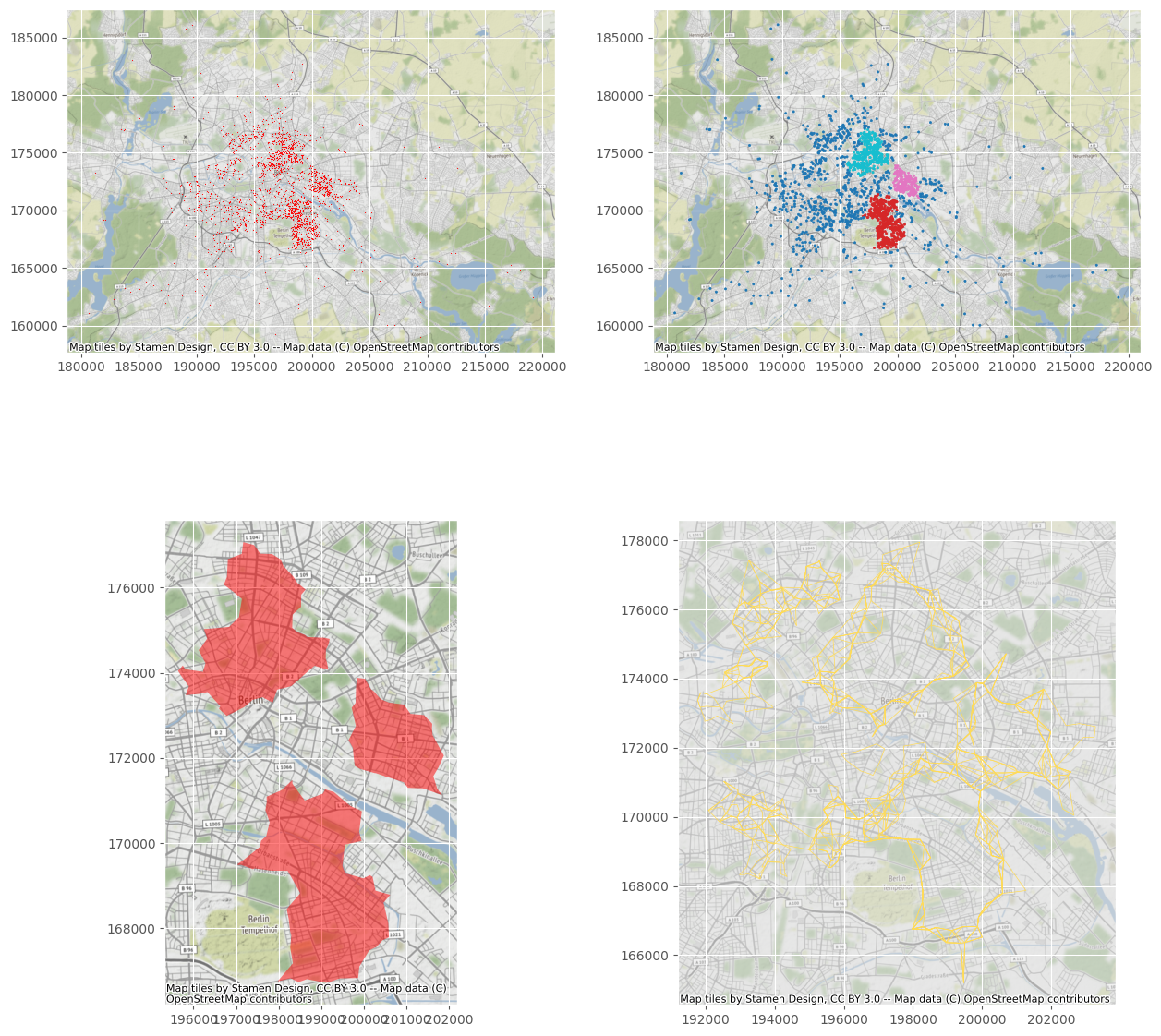
Cluster points and explore boundary blurriness with A-DBSCAN
geospatial
map
Clustering
Approximate DBSCAN (A-DBSCAN), its purpose is to detect robust clusters of neighbors that reach a minimum density threshold.